
Flying locations
Where you can fly unmanned aircraft in Lithuania
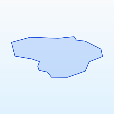
Key facts
Max altitude
120 m AGL
Urban distance
≥ 150 m
Flight mode
VLOS
Before flying
Geo-zone map
General rules across Lithuania
Before choosing a location, always check the UAS geo-zone map. EU Open category rules apply across Lithuania:
- Maximum altitude: 120 m AGL (Open category A3).
- Distance from urban areas: no closer than 150 m (A3 subcategory).
- VLOS: the aircraft must remain in sight at all times.
- Prohibited: over crowds, large events, military sites, critical infrastructure, aerodrome controlled airspace without permission.
- Private land: owner consent required to fly over and land on the property.
Below are recommended locations by region. Before every flight verify the zone is not in prohibited or restricted airspace.
Vilnius region
Vilnius International Airport (VNO) — strict flight restriction zones. Avoid flying in central Vilnius and near the airport.
Recommended spots (verify geo-zones):
- Open meadows in Pavilniai and Verkiai regional parks — away from urban areas, suitable for A3 flights.
- Nemenčinė and Molėtai highway surroundings — open fields 150+ m from residential areas.
- Trakai district — lakeshores (Lake Trakai — avoid castle and tourist crowds overhead).
- Elektrėnai and Kaišiadorys surroundings — open spaces near lakes.
- Medininkai Hill — great views, but near border zone — check sensitive areas.
Flying in central Vilnius is practically not permitted due to urban density and airport proximity.
Kaunas region
Kaunas Airport (KUN) — controlled airspace around the airport.
Recommended spots:
- Kaunas Lagoon surroundings — open shores and meadows (avoid beach crowds in season).
- Vievis and Daugai — lakeshores with open spaces.
- Raseiniai and Ariogala surroundings — open fields away from urban areas.
- Along Kaunas–Alytus road — rural areas with low population density.
- Kulautuva — forest and meadow areas, but check distances from Nemunas and residential homes.
Flying in central Kaunas and Aleksotas is not recommended due to dense urbanisation.
Klaipėda and coastal region
Palanga Airport (PLQ) and seaport zone — strict restrictions.
Recommended spots:
- Klaipėda and Smiltynė surroundings — open fields away from port and airport (geo-zone check mandatory).
- Curonian Lagoon (Neringa) — stunning views, but sensitive border and security zone — only after map verification.
- Priekulė and Gargždai surroundings — rural spaces.
- Šilutė district — Nemunas delta, open fields (check Ramsar and nature protection zones).
- Kretinga and Plungė surroundings — open fields and lakes.
Flying over beach crowds is prohibited. Avoid port, border, and military site zones.
Šiauliai and northern Lithuania
Šiauliai Airport (SQQ) — military and civil airport, strict zones.
Recommended spots:
- Radviliškis and Pakruojis surroundings — wide open meadows.
- Joniškis and Akmenė districts — open fields, low urbanisation.
- Biržai and Pasvalys surroundings — rural areas, suitable for long VLOS flights in open terrain.
- Linkuva and Sidabrė surroundings — meadows and forest clearings.
- Tauragė and Jurbarkas districts — open Nemunas valley spaces.
Flying near Zokniai military aerodrome without permission is prohibited.
Panevėžys and eastern Lithuania
Panevėžys aerodrome (PNV) — restricted airspace.
Recommended spots:
- Panevėžys and Ramygala surroundings — open fields outside city limits.
- Anykščiai and Utena districts — lakeshores (Alaušas, Tauragnas, Sartai — check nature park rules).
- Zarasai and Visaginas surroundings — open spaces, but near border — sensitive zones.
- Rokiškis and Kupiškis districts — rural meadows and fields.
- Ignalina district — lake and forest areas (check Dukštas and Aukštaitija park zones).
Aukštaitija National Park may require director permission.
Alytus and southern Lithuania
Recommended spots:
- Alytus surroundings — open fields outside the city, away from residential areas.
- Druskininkai and Merkinė surroundings — forest areas (Dzūkija National Park — permission required).
- Lazdijai and Varėna districts — open meadows, near Belarus border — sensitive zones.
- Marijampolė and Kalvarija surroundings — rural spaces.
- Lake Meteliai and Dusia surroundings — open shores (check protected areas).
Southern Lithuania has many border zones — always check the geo-zone map.
Locations where flying is prohibited or restricted
Geo-zone colour guide
Prohibited
No UAS flight without special authorisation
Restricted
Permission or NOTAM check required
Sensitive
Nature reserves, borders, infrastructure
Open (check rules)
Open category A3 if distance & altitude rules met
Across Lithuania UAS flights are prohibited or restricted in:
- Aerodrome controlled and restricted airspace (VNO, KUN, PLQ, SQQ, PNV, etc.)
- Military sites and training grounds (e.g. Gaižiūnai training area)
- State border strips and sensitive zones
- Critical infrastructure: hydro plants, bridges, railways, high-voltage lines
- Over crowds, large events, sports competitions
- National parks — without director permission (Aukštaitija, Dzūkija, Samogitia, Curonian Spit)
- Bird and nature reserves (Ramsar zones, strict nature reserves)
- Central urban areas of Vilnius, Kaunas, Klaipėda (A3 distance requirement)
Always use the official UAS geo-zone map before every flight.