
Miejsca do latania
Strefy zakazu i ograniczeń BSP w Bośni i Hercegowinie
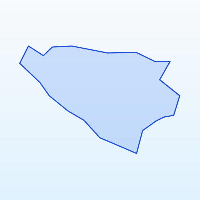
Najważniejsze
Maks. wysokość
120 m
Odległość od miast
≥ 150 m
Tryb lotu
VLOS
Przed lotem
Mapa stref geo
Aerodrome zones
Strefy wpływu głównych lotnisk
Sarajevo
Capital FRZ
Banja Luka
Northern region
Mostar
Southern region
Main aerodromes and their impact zones. Around each aerodrome the geo-zone map marks FRZ and CTR areas. Flying there without permission is prohibited.
- Sarajevo (SJJ) — Capital FRZ
- Banja Luka (BNX) — Northern region
- Mostar (OMO) — Southern region
Military and security zones
In Bośni i Hercegowinie UAS flights are prohibited or strictly restricted in:
- Military training areas and bases
- Border protection strips
- Seaports and strategic facilities
- Protected government sites
These zones are marked on the geo-zone map as prohibited (red) or restricted (amber).
Nature protection and reserve zones
Flights in nature areas may be restricted to protect wildlife:
- National parks (Sutjeska, Una, Kozara) — permission may be required
- Strict nature reserves — flights often prohibited
- Ramsar wetlands and bird protection areas
- Nesting and migration sites during sensitive seasons
Contact park administration or check official rules before flying over nature sites.
How to check zones before flying
Przewodnik kolorów stref geo
Zakaz
Lot BSP bez specjalnego zezwolenia zabroniony
Ograniczony
Wymagane zezwolenie lub sprawdzenie NOTAM
Wrażliwa
Rezerwaty, granice, infrastruktura
Otwarta (z zasadami)
Kategoria Open A3 przy zachowaniu odległości i wysokości
Recommended verification sequence:
- 1Open the official Bośni i Hercegowinie / EU UAS geo-zone map
- 2Enter flight coordinates or mark the area on the map
- 3Review colour coding: red = prohibited, amber = restricted, blue = sensitive
- 4Check NOTAM notices for temporary restrictions
- 5If a zone is restricted — contact the competent authority for permission
- 6Record the check date and result in your flight log
SkrisT recommends using only official sources — geo-zone data may change.